Disclosure: CommsGearReport.com participates in the Amazon Associates program and other affiliate programs. If you purchase gear through links on this page, we may earn a commission at no additional cost to you. Affiliate relationships never influence our technical assessments or recommendations.
ATAK gets name-dropped constantly in ham radio forums, prepper communities, and emergency preparedness circles. It shows up in YouTube thumbnails next to Samsung phones mounted on body armor, in CERT training discussions, and in ARES nets whenever someone wants to sound serious about digital communications. The pitch is compelling: military-grade situational awareness, real-time team tracking, shared maps, and data coordination — free, on Android, accessible to anyone.
That pitch is not wrong. ATAK genuinely delivers those capabilities. The question this article is actually answering is a different one: what does it cost to make those capabilities functional, and does that cost make sense for your team?
The answer depends almost entirely on your infrastructure, your team’s technical depth, and your operational context. This is not a tool you install and use. It is a system you build, configure, train for, and maintain. For the right teams in the right situations, that investment pays off substantially. For a lot of the teams currently getting excited about ATAK, it will stall in a frustrating half-deployed state and collect digital dust.
Here is what you need to know to figure out which category you’re in.
What ATAK Actually Is
The Android Team Awareness Kit — ATAK — is a geospatial situational awareness platform originally developed in 2010 by the Air Force Research Laboratory for U.S. Special Forces. It has been tested and refined through years of operational military use, which is both the source of its capability and the root of its civilian learning curve problem.
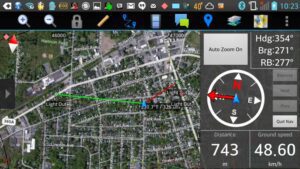
At its core, ATAK is a moving map application with a collaborative layer on top. Every user in a network sees every other user’s position on a shared map in real time. That shared picture also includes user-drawn objects, routes, areas of interest, geofences, and whatever sensor data the team has piped into the system — including live drone video feeds from DJI and Autel platforms via the UAS plugin. The map supports online and offline sources, KML/KMZ/GPX overlays, DTED and SRTM elevation data, heat maps, computed viewsheds, and sub-centimeter resolution imagery when you have access to it.
ATAK-CIV is the civilian-accessible version, maintained by the TAK Product Center and available on the Google Play Store (most recently updated January 31, 2026). It is also fully open-source, with the source code published at github.com/deptofdefense/AndroidTacticalAssaultKit-CIV. The civilian build lacks a handful of military-specific features — certain precision targeting and fire mission tools are disabled in the public release — but the core platform is functionally identical to what DoD users run, and civilian and military ATAK devices are fully interoperable on the same network.
The communication protocol that makes all of this work is Cursor-on-Target (CoT), an XML-based message format that ATAK uses to exchange data between devices and servers. A CoT event is structured data: it carries position (latitude, longitude, altitude), timestamps, device identifiers, and event type — which might be a friendly position report, an alert, a route waypoint, or a custom data object. Everything visible on an ATAK map is, at some level, a CoT message in transit or stored from a previous transmission.
This matters because understanding CoT is the key to understanding both ATAK’s power and its infrastructure requirements. CoT is transport-agnostic — it can travel over LTE, Wi-Fi, a local IP network, or any radio link that can carry IP data. The question of whether ATAK works in your operational environment is really a question of whether you can move CoT packets between devices. Everything else follows from that.
The TAK Ecosystem: What the Pieces Are
ATAK on Android is one component of a broader family of interoperable tools.
WinTAK is the Windows desktop version, oriented toward command post or operations center roles. It runs the same CoT stack, sees the same shared picture, and is particularly useful for incident commanders or net control operators who need a larger display and more comfortable interface for managing a complex operational picture. It is not a replacement for ATAK in the field, but it is a natural complement in any deployment that has a fixed coordination point.
iTAK is the iOS version, developed for Apple devices. Its feature set lags the Android build, and the broader TAK community treats it as a second-tier option — functional, but not the primary platform for serious deployments.
FreeTAKServer and OpenTAKServer are the two primary open-source server options for civilian deployments. FreeTAKServer has a longer history in the community but recent reports indicate it is no longer actively maintained, with many users encountering installation difficulties in 2025. OpenTAKServer (OTS) has become the community-preferred alternative — described as significantly easier to configure, with active development and a responsive Discord support community. For new civilian deployments in 2026, OTS is the more defensible choice. Both can run on a Raspberry Pi for field-portable deployments or on a cloud VPS (DigitalOcean is a common choice) for persistent team infrastructure.
The TAK Product Center also publishes an official TAK Server build through tak.gov, which some operators prefer for stability despite requiring more manual configuration.
The current release across the TAK product line is version 5.6, as of March 2026, which introduced additional performance, collaboration, and mission-effectiveness enhancements per the TAK Product Center’s release documentation.
The Infrastructure Reality Nobody Puts in the Thumbnail
This is where the hype-to-reality gap opens up, and it is worth being direct about it.
ATAK without a functional data link is a local GPS app with an elaborate UI. It will show your own position. It will display imported maps. It will not share anything with anyone. The situational awareness capability — the feature that makes ATAK worth discussing — requires every member of your team to be exchanging CoT packets on a common network in real time.
In urban or suburban environments with reliable cellular coverage, this is straightforward. Every device uses LTE, you point everyone at a cloud-hosted TAK Server, and the system works. This is also exactly the connectivity environment most likely to remain functional in a non-disaster scenario and most likely to fail in the degraded environment where a civilian team actually needs ATAK.
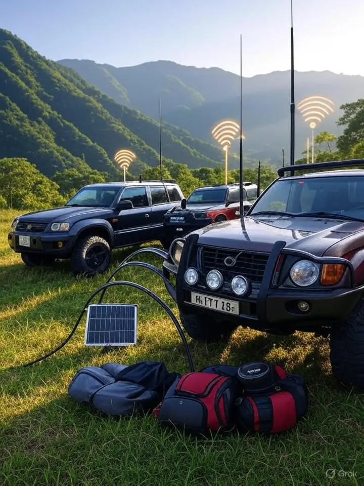
In a grid-down scenario — the natural disaster that took out cell infrastructure, the remote SAR operation in a canyon with no signal, the large planned event with overloaded towers — you need a different data link. Your options break into three architectural approaches.
Local IP mesh involves creating a local Wi-Fi network (a hotspot from a device with connectivity, a dedicated router, or a MANET radio setup) and running a local TAK Server that all devices connect to directly. This keeps the network functional within Wi-Fi range but doesn’t extend beyond it. For a team operating in close proximity — think a CERT staging area or a perimeter security deployment — this is workable.
Meshtastic LoRa bridge is the approach that has generated the most traction in the civilian ATAK community for genuinely off-grid operation, and it deserves a dedicated section.
Satellite backhaul via Starlink or similar services can bridge a local TAK server to a cloud instance, extending the network to include remote operators with internet access. This is a hybrid architecture and requires the Starlink terminal to remain operational and positioned, which adds logistical complexity.
Meshtastic as Your Data Link: The Honest Assessment
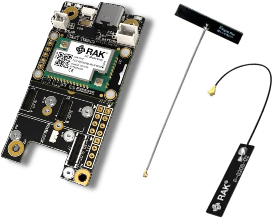
Meshtastic is an open-source LoRa mesh networking project that allows low-bandwidth, license-free communication over the 915 MHz ISM band (in North America). Devices form a mesh network, relay packets through multiple hops, and can bridge to IP networks. Range in open terrain is typically 1 to 10 kilometers per hop, extending further with additional nodes. It requires no cellular infrastructure and no licensed spectrum for basic operation.
The connection between Meshtastic and ATAK is made through the ATAK-forwarder plugin, available at github.com/paulmandal/atak-forwarder. This plugin acts as a bridge between the Meshtastic mesh and the ATAK CoT layer, allowing position reports, GeoChat messages, and map markers to pass between ATAK users over LoRa links with no internet connectivity required. The plugin is community-developed, not an official TAK Product Center release, and its development status varies — check the repository for current version compatibility before deploying.
What it does well in the field: basic position location information (PLI) is reliable and useful after initial configuration. Teams running this stack — ATAK on Android, Meshtastic hardware bridged via the plugin, positions updating every one to five minutes — describe a functional shared operational picture for small teams in off-grid environments. SAR teams and volunteer fire brigades in the US and Europe are actively testing this combination, with some running ATAK and WinTAK together — ATAK on field team devices, WinTAK at the command post — for sector assignment and track management during missing-person searches. A dedicated Search and Rescue plugin, developed by AFRL, was released to the civilian community in March 2026, directly targeting this use case.
What it does not do well: Meshtastic’s bandwidth is extremely limited by the physics of LoRa spread-spectrum communication. The link supports CoT position packets and short text messages. It does not support file transfer, photo sharing, or video streaming. The full multimedia capability of ATAK requires an IP data link with meaningful bandwidth — LoRa is not that link. If your operation depends on video feeds from a drone or large file distribution, Meshtastic gets you the map layer only.
The community has also identified specific configuration decisions that make or break the Meshtastic-ATAK bridge in field use. Using the ShortFast preset (rather than the default LongFast) provides better throughput with acceptable range for team operations. Hop count should be set to 3, not the default 7 — excessive hop counts cause packet collisions that degrade the network. Position reporting rates need to be reduced from aggressive defaults to prevent channel congestion; updates every 1 to 5 minutes are the community consensus for most deployments. Version matching between the Meshtastic firmware, the Meshtastic Android app, and the ATAK-forwarder plugin is a persistent compatibility issue — mismatches between releases are the most frequently cited failure mode in troubleshooting threads.
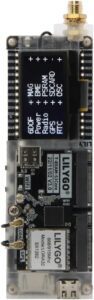
For LoRa hardware, the community’s current preference leans toward RAK Wireless modules for reliability, with LilyGO T-Beam (particularly the Supreme variant) used widely but with more reported quality variation. Basic Heltec and generic LilyGO devices get mixed reviews in operational contexts.
Other Radio Data Links: APRS-TAK and HAMMER
Two additional plugins extend ATAK to licensed radio infrastructure worth knowing about.
APRS-TAK (github.com/pinztrek/aprstak) bridges the APRS (Automatic Packet Reporting System) network — which already carries position data on 144.390 MHz in North America — into the ATAK map layer. For licensed amateur radio operators already running APRS-capable equipment, this provides a path to get positions into ATAK over an established, wide-area infrastructure with no additional hardware beyond what you likely already have. The regulatory implications of this approach are covered in the callout section below.
HAMMER (github.com/raytheonbbn/hammer) takes a different approach: it functions as an audio modem, encoding CoT data as audio tones transmittable over any push-to-talk radio, including unlicensed FRS/GMRS handhelds and licensed amateur equipment. The bandwidth is narrow and the use cases are specific, but it provides a path to move basic positional data over any radio link you already have, without requiring a data-capable radio. Maturity is described as community-driven; treat it as experimental until you have tested it against your specific hardware.
Where ATAK Earns Its Complexity
There are operational contexts where ATAK’s capability is not just incremental but qualitatively different from the alternatives, and where the investment in setup and training pays a clear return.
Search and rescue operations involving multiple teams operating across separate sectors are a strong fit. The ability to track each team’s position in real time, assign sectors on a shared map, mark last-known-position data, share route information, and log the operational picture over time addresses real coordination problems that radio voice alone handles clumsily. The AFRL SAR plugin adds structured missing-person search tooling on top of that foundation.
Large-scale planned events with a coordinating command structure — multi-agency exercises, large CERT activations, community emergency response drills — benefit from ATAK’s ability to create a shared common operating picture that persists as the event unfolds. Individual radio check-ins establish positions momentarily; ATAK tracks them continuously.
Wildland fire operations are an area where TAK has genuine documented adoption at the public safety level. Texas DPS used ATAK during the 2025 flooding response with satellite imagery integration. Corona, California Fire has documented the value of the TAK ecosystem for UAS integration in fire response. The ability to overlay real-time drone feeds, fire perimeter data, and resource positions on a common map has real operational value that simpler tools cannot replicate.
Teams with a dedicated technical administrator who can manage server infrastructure, train members, and maintain the system between activations are positioned to get genuine value from ATAK. The capability is real. The overhead is also real, and it requires someone to own it.
Where ATAK Doesn’t Earn Its Complexity
Small teams — two to four people — operating in a defined area with a simple coordination task have faster, lighter options that work just as reliably without the configuration overhead. A shared location-sharing app and a pair of capable radios solves most small-team coordination problems at a fraction of the setup cost.
Non-technical organizations without a dedicated system administrator will almost universally stall during deployment. User reviews of ATAK-CIV on the Google Play Store are consistent on this point: “you’ll need to read the manual and train your team,” “it’s not exactly turn-key,” and “this could be great if your whole group is coders.” These are not complaints about a bad product — they are accurate descriptions of the prerequisite investment. An organization that cannot commit to training and administration will end up with ATAK installed on a handful of phones and never used operationally.
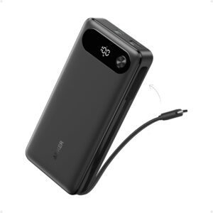
Battery consumption is a serious field consideration that is consistently underreported in enthusiast coverage. ATAK running with active GPS, a live network connection, and the Meshtastic plugin will drain a phone meaningfully faster than normal use. Field deployments require a power management plan — battery packs, charging infrastructure, or device rotation.
Teams expecting ATAK to work immediately in a grid-down scenario, without pre-built infrastructure, will be disappointed. The system does not configure itself under stress. Everything that makes ATAK functional in a degraded environment — the local server, the Meshtastic mesh, the encryption keys, the map packages pre-loaded for offline use — has to be built, tested, and validated before the activation happens.
Regulatory Callout: Know What You’re Transmitting Over
ATAK itself is software. The TAK Product Center distributes ATAK-CIV through the Google Play Store, it is open-source under DoD authorization, and it carries no FCC licensing requirement. Civilian use of the software is unrestricted, and it is not export-controlled (it carries an EAR99 designation, making it accessible without export license to most destinations outside sanctioned entities). There are no federal regulatory restrictions on running ATAK-CIV as a civilian.
The regulatory questions arise from the data links you use to move CoT packets between devices, not from the software itself.
LoRa/Meshtastic (Part 15): Meshtastic devices operating in the 915 MHz ISM band in North America operate under FCC Part 15 as unlicensed intentional radiators. No license is required to transmit. Power output is limited — the specific ceiling depends on the band and antenna configuration, but generally runs to approximately 30 dBm (1 watt) EIRP maximum — and Part 15 devices must accept interference from other users and may not cause harmful interference to licensed services. This is a workable regulatory framework for civilian ATAK operations, and the license-free nature of Meshtastic is a significant practical advantage over licensed alternatives. The trade-off is that Part 15 operation provides no protection from interference and no dedicated spectrum — in a congested RF environment, performance can degrade.
Amateur radio data links (Part 97): If you are a licensed amateur radio operator considering carrying ATAK CoT data over an amateur digital link — packet radio, VARA, an APRS feed via APRS-TAK, or any other ham-band data mode — Part 97 imposes meaningful constraints that the Meshtastic route does not. Most critically: Part 97 prohibits encryption of amateur radio transmissions for the purpose of obscuring the meaning of communications. ATAK supports AES-256 mesh encryption, which is appropriate for Part 15 Meshtastic operation but is not permissible on amateur radio transmissions. Operators using APRS-TAK or any ham-band CoT link must transmit unencrypted position data. Additionally, Part 97 prohibits third-party business communications and requires station identification. Any amateur-band ATAK link is subject to those rules regardless of what software is generating the traffic. Operating a ham-band ATAK link without a valid license is an FCC violation — the data content doesn’t change the licensing requirement.
Cellular/LTE: Teams using LTE as their primary TAK data link are operating over commercially licensed spectrum. Individual users need no license — their cellular plan covers it. The regulatory concern here is practical rather than legal: LTE infrastructure is the first thing to degrade in a major disaster, which is precisely the scenario where ATAK’s capability is most needed. LTE-dependent ATAK is a fair-weather architecture.
Licensed Land Mobile Radio (LMR): Some professional and quasi-professional civilian deployments carry TAK data over licensed LMR spectrum. This requires an FCC Part 90 license for the frequency in use and is generally outside the scope of ham or unlicensed civilian deployments, but worth knowing exists as an architecture for organizations with existing licensed spectrum.
Hardware: What You Actually Need
ATAK-CIV requires Android 5.0 (API level 21) or later and a graphics processor supporting GLES 3.0. The TAK Product Center recommends Samsung Galaxy S9 equivalent or newer for phones and Samsung Galaxy Tab S2 equivalent or newer for tablets. In practice, any capable mid-range Android device from the last five years will run it adequately. The performance-limiting factors in a real deployment are GPS accuracy, battery life, and screen visibility — not raw processing power.
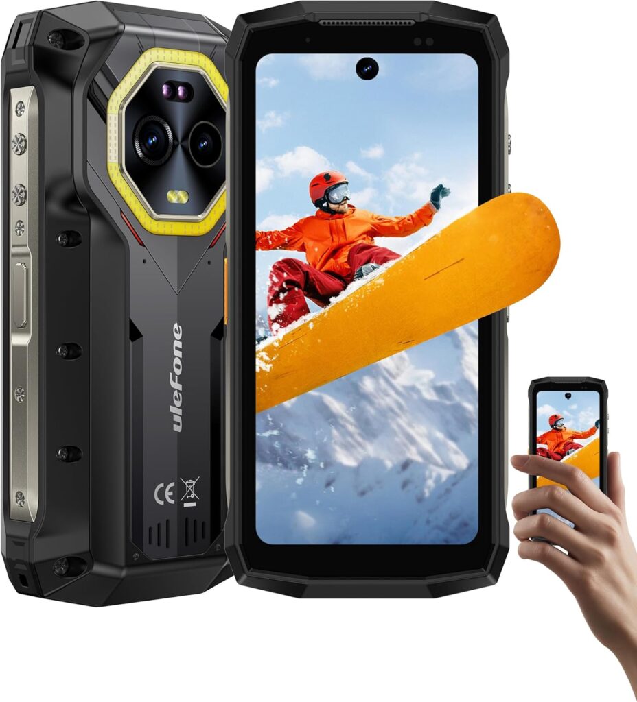
The community runs ATAK on a wide range of hardware. Samsung Galaxy devices remain common. Google Pixel phones — particularly the 6 and 6a as affordable refurbished options — are gaining traction among privacy-conscious operators running GrapheneOS. Rugged options with large batteries include the Ulefone Armor series, which trades weight and bulk for weather resistance and extended runtime. The Samsung Galaxy XCover6 Pro sees use in more professional public safety contexts.

For Meshtastic hardware paired with ATAK, the specific device matters for reliability in operational conditions. RAK Wireless modules are currently the community preference for dependability. LilyGO T-Beam Supreme gets favorable reviews for GPS performance. Avoid cheap or counterfeit LoRa modules for operational deployments — the failure modes are difficult to diagnose in the field.
Field protection for Android devices running ATAK is a real consideration. Juggernaut Case and Kägwerks produce phone cases specifically designed for ATAK EUD use, with MOLLE and vehicle mounting options.
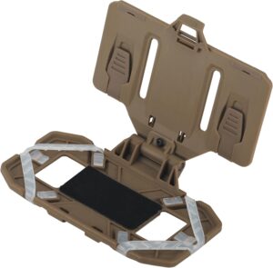
For mounting your EUD to a plate carrier or chest rig, the EralcNa Tactical Phone Chest Mount is a reliable and affordable option. At only 5 oz., it attaches to any MOLLE/4×3 webbing surface and fits smartphones from 4.7″ to 6.7″ — covering the Samsung Galaxy XCover6 Pro, Google Pixel 6a, and most Android devices used as ATAK EUDs. Multiple silicone non-slip strips hold the phone securely during movement, and the quick-release buckle allows phone access in under 30 seconds.
The Honest Alternatives
If you have read this far and are concluding that ATAK’s overhead may not match your team’s situation, these alternatives deserve an honest look.
Meshtastic standalone — without ATAK — provides position sharing, text messaging, and group chat over the same LoRa mesh infrastructure. The interface is far simpler, the setup is considerably lighter, and for a team that primarily needs to know where each other are and communicate short messages off-grid, it may solve the actual problem without the ATAK superstructure. It lacks shared mapping, collaborative drawing, and the full CoT data model, but those capabilities only matter if you are going to use them.
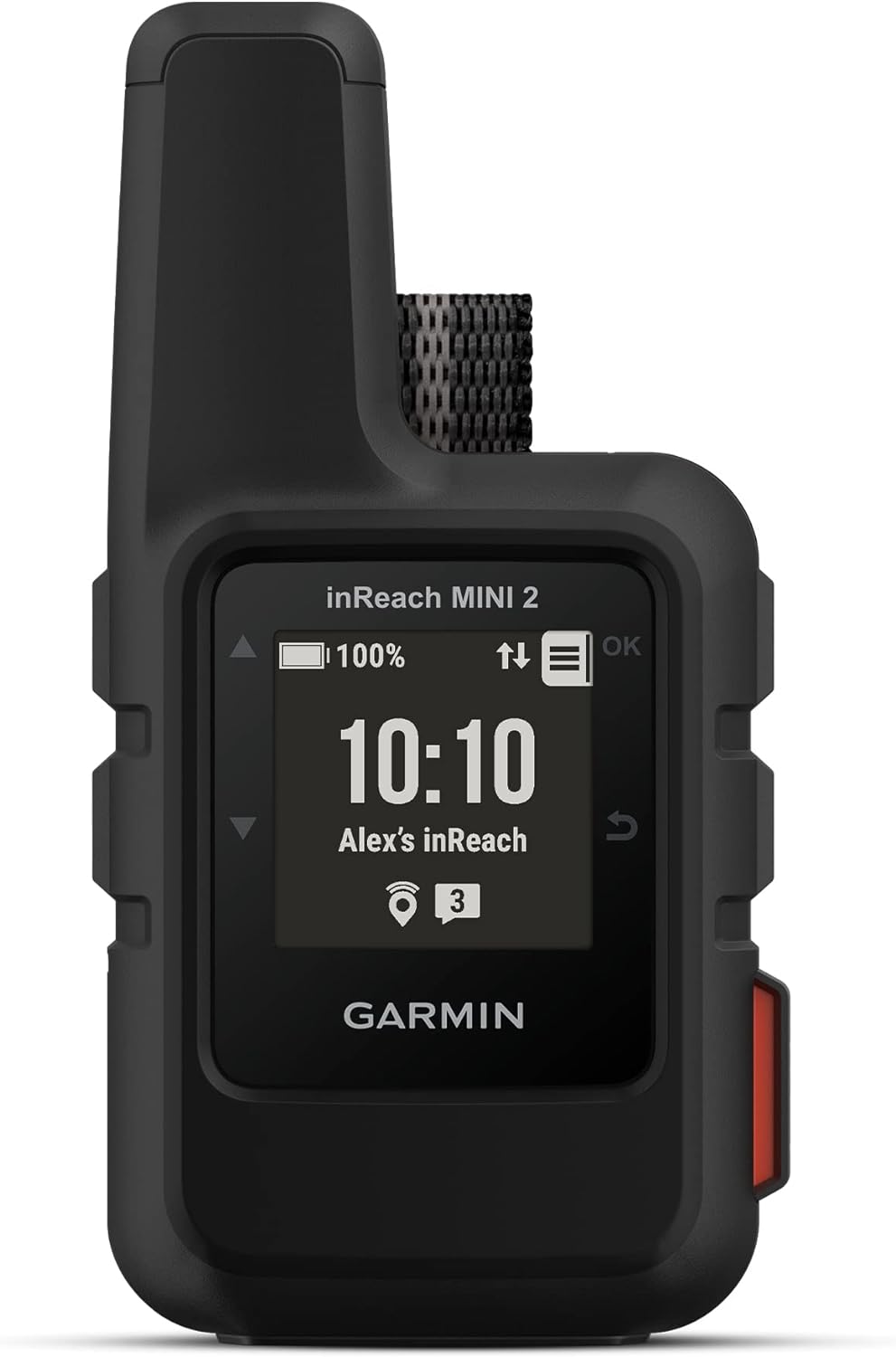
Garmin inReach provides satellite-based two-way messaging and position tracking that works globally with no infrastructure dependencies. It is not a team coordination platform in the ATAK sense — it does not give you a shared live map — but it provides highly reliable individual tracking and SOS capability that ATAK over Meshtastic cannot match for remote solo or small-group operations.
Zello over LTE provides push-to-talk voice coordination that is simpler and more immediately understandable to non-technical team members than any TAK interface. It does not give you geospatial awareness, but it gives you reliable voice when cellular is up — and most activations occur in environments with at least some cellular coverage.
CalTopo and SARTopo are web-based mapping tools with sharing features designed specifically for search and rescue operations. They are not real-time tracking platforms in the ATAK sense but provide collaborative map annotation, sector assignment, and documented operational planning tools that are more immediately accessible to volunteers than a full ATAK deployment.
None of these alternatives are ATAK. None of them deliver what ATAK delivers when ATAK is properly deployed and functioning. The question is whether you will reach that state.
The Verdict
ATAK is not overkill for civilian teams. It is the right tool for a specific class of civilian operation: multi-person teams conducting coordinated field operations that require shared geospatial awareness, with the organizational capacity to build and maintain the underlying infrastructure, and the commitment to train every participating member before the activation happens.
For those teams, the recent trajectory of the TAK ecosystem makes civilian deployment more accessible than it has ever been. OpenTAKServer has simplified server deployment meaningfully. The Meshtastic ATAK-forwarder plugin has created a credible off-grid data link for teams with basic LoRa hardware. TAK 5.6 brought continued capability refinement. The AFRL SAR plugin release in March 2026 added structured search tooling that directly addresses civilian SAR use cases. CivTAK.org and the r/ATAK community provide active support resources that didn’t exist at this quality level five years ago. The ecosystem is maturing in the civilian direction.
For teams without a dedicated technical administrator, without the bandwidth to train members to operational competency, or with operational requirements that a simpler tool can genuinely satisfy — ATAK is not the answer yet. It may be the answer after you build toward it, starting with Meshtastic standalone and working toward ATAK integration once your team is comfortable with the concepts.
The most honest summary: ATAK delivers what it promises. What it costs to make it deliver is the part of the conversation that usually gets skipped. Now you have both halves.